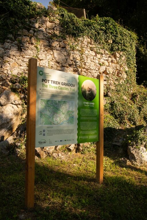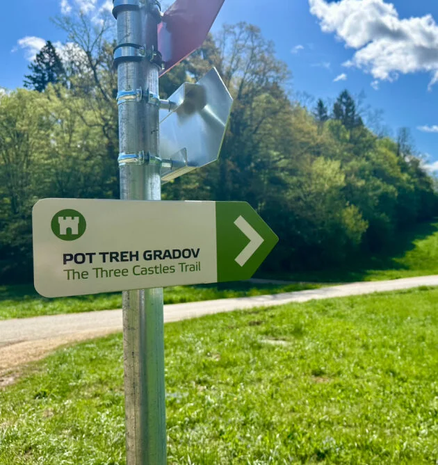
The Three Castles Trail
The Three Castles Trail is a scenic hiking route of around 8.7 km, linking three important castles near Trška Gora in the Dolenjska region: Otočec Castle, Stari Grad (Old Castle), and Hmeljnik Castle. Designed as an easy, varied walk, it’s ideal for recreational hikers, families, and anyone who loves nature and history. Along the way, cultural heritage, natural sights, and the culinary character of this wine-growing landscape come together.
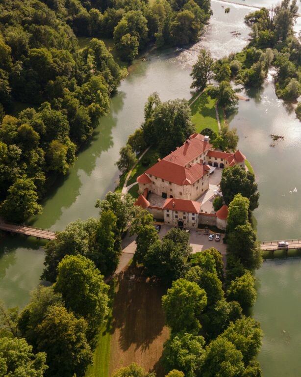
The trail begins at Otočec Castle, the only river castle in Slovenia, set on an island in the middle of the Krka River. Now a luxury hotel, it is surrounded by a beautiful park, and the bridge offers lovely views over the calm water. From here, the route continues through Šempeter, where it connects with the Rudolf Trail and Trdina Trail, then climbs into the hills.
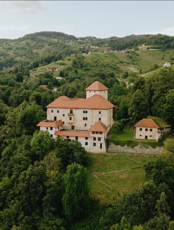
The next highlight is Stari Grad, perched on a viewpoint above Trška Gora. These medieval remains hint at the site’s former strategic and administrative role. The trail then passes natural features such as Becelet’s Cave and crosses the Lešnica stream, opening up into a classic Dolenjska scene of vineyards and zidanice (vineyard cottages).
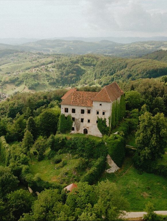
A standout moment is the Golušnik viewpoint, where you can enjoy panoramic views of the Krka Valley and the surrounding hills. After a short climb through the vineyards, the path reaches the third castle: Hmeljnik, the ruins of a once-mighty stronghold above the wine slopes, protected as a cultural monument since 1999. Here you’ll find an information board, benches for a break, and the option to refresh yourself with local winemakers nearby.
The final section leads to the village of Karteljevo, where it is possible to arrange transport back to the starting point at Otočec. The route includes around 500 m of total ascent and takes about 2.5 to 3 hours at a moderate pace. Wear suitable footwear, bring some water, and most importantly: bring an open heart for experiencing Dolenjska in all its richness.
Summary
Distance: approx. 8.7 km
Total ascent: around 500 m
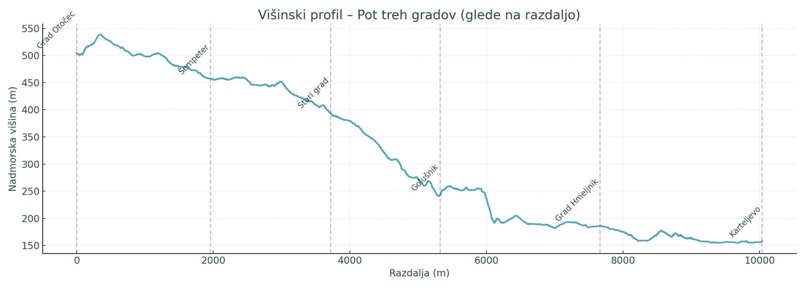
Highest point: approx. 539 m a.s.l.
Lowest point: around 155 m a.s.l. (Otočec Castle)
Walking time: approx. 2.5–3 hours
Difficulty: easy to moderate, suitable for families and recreational hikers
Waymarking: well marked; connections possible with other local trails (Trdina Trail, Rudolf Trail)
Elevation profile
Trail Map
More themed walking trailsDownload the GPX track